
Whether you’re a professional photographer or an amateur, the Great Smoky Mountains National Park is one of the most diverse and photogenic landscapes in the United States. Verdant forests, long range mountain views, beautiful streams and serene valleys make this national treasure one of the richest experiences for landscape photography. Read along to find the best spots for sunrise and sunset photography on the North Carolina side, along with great photo opportunities along the way.
Our location descriptions are described via mileage distance from the Cherokee entrance to the Park (US 441/Newfound Gap Road), using the Great Smoky Mountains Entrance Sign as a starting point. You will find some mile markers along the way, however these are sometimes hard to find during snow events or tall summer grass.
Click or tap images to enlarge.
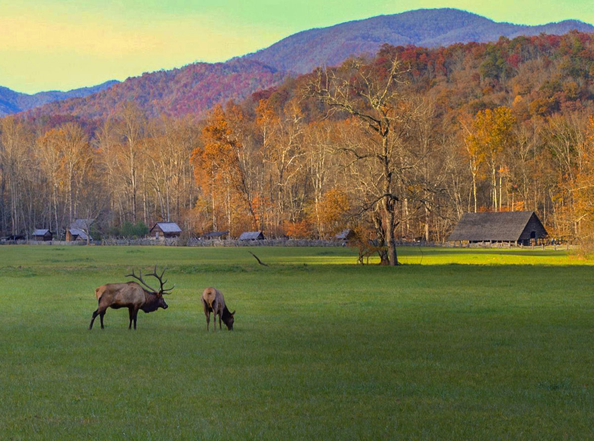
At 9/10ths of a mile, look to the right for the entrance to the Oconaluftee Visitor Center. This is the parking area for exploring the Mountain Farm Museum. There is a good chance you’ll see elk grazing in the field here during certain times of the day.
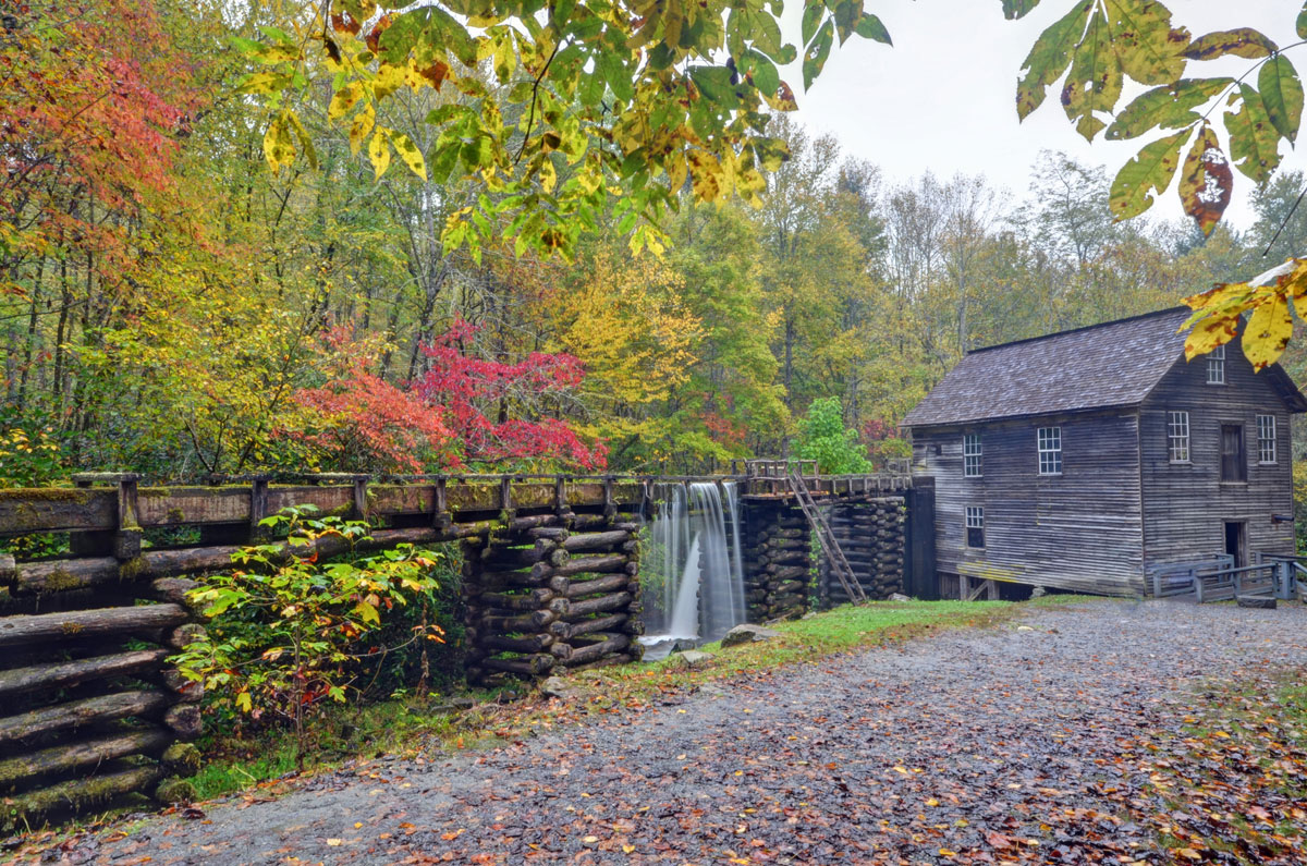
At 1.6 miles, look for the left turn into Mingus Mill. There are some great photo opportunities here. One of our favorites is to stand at the far end of the millrace – on the board that crosses over the millrace – looking toward the mill. This puts the millrace in the foreground of the photo with the mill in the background.
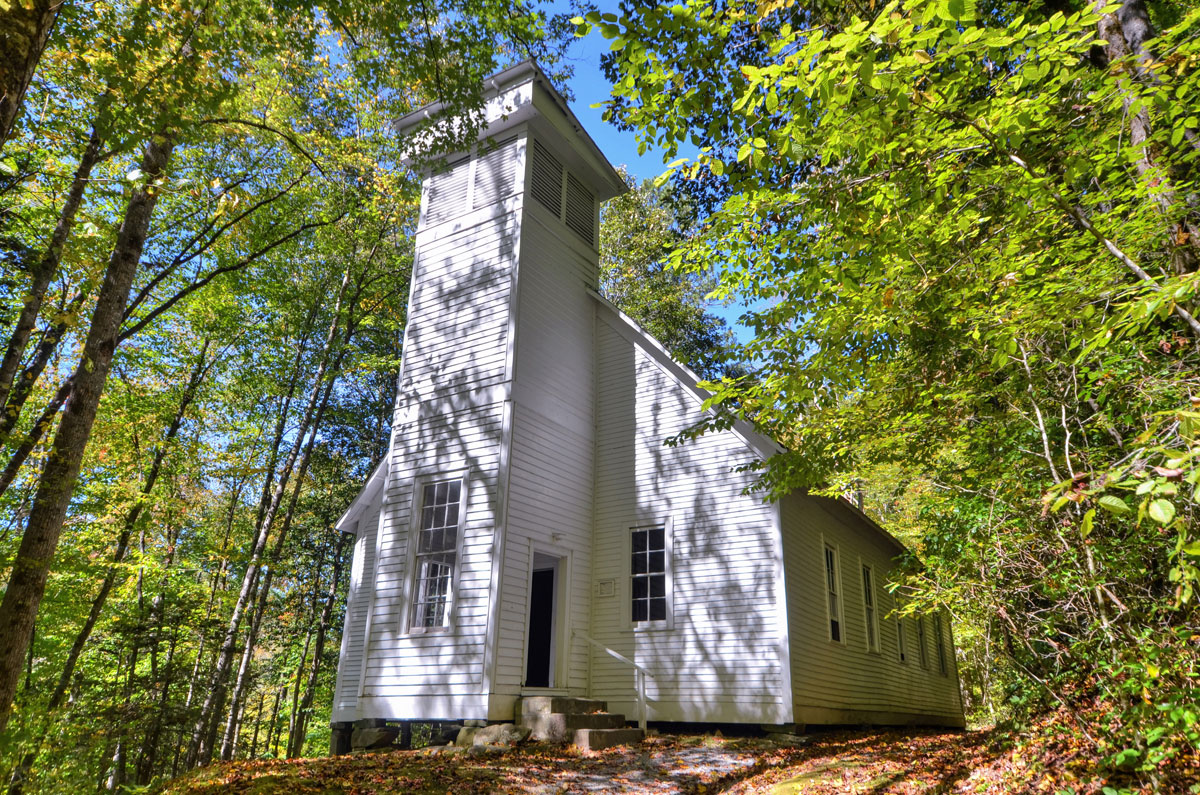
At 4.1 miles, look for the right turn into the Smokemont area. Trails in the area will wind through very scenic terrain. If you’re pressed for time, park in the parking lot straight ahead from the right turn and tour the Smokemont Church. Spring and fall are great times to get photos of pretty foliage around the church and steeple.
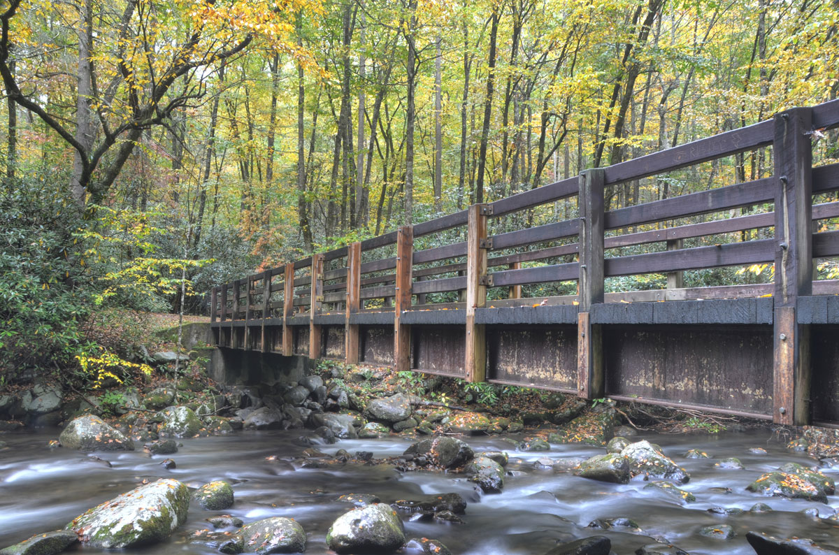
At 7.9 miles, look for parallel parking on both sides of the road. This is the parking area for the Kephart Prong Trail, which starts out as a bridge over the Oconaluftee River. Standing at the foot of the bridge creates a great photo especially in the fall. You can also capture scenes on the bridge looking to the right; you’ll get a long view of the river with overhanging trees. Or climb down the embankment on the left side and photograph the bridge going over the river.
US 441/Newfound Gap Road continues to climb to the higher elevations of the Park, where long range views of mountain ridges are plentiful. Most of these overlooks and parking areas will be on the left side.
The first long-range overlook after Kephart Prong trailhead is at 12.7 miles and is not the most ideal for photo opportunities. However if this is your first visit to the Park, it is tempting to turn in for your initial glimpse of the majestic mountains.
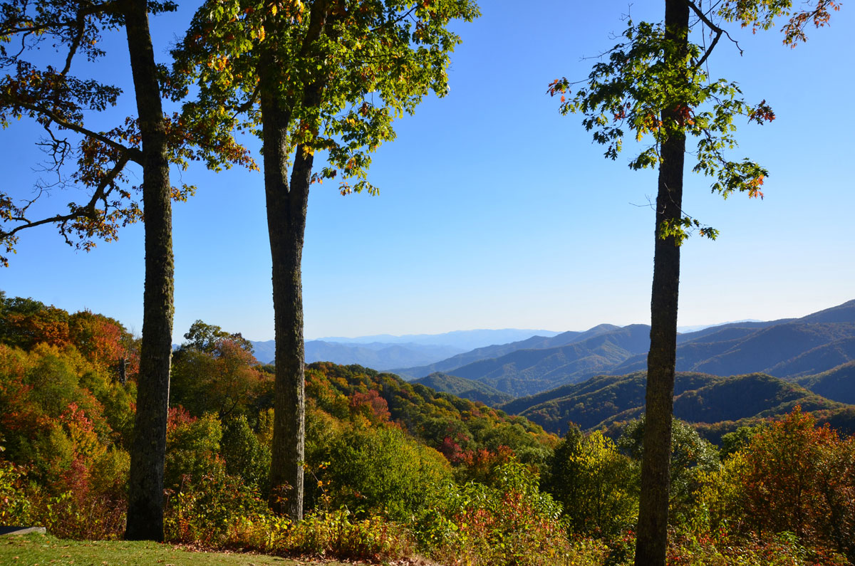
Long range views are much better from the next overlook, at 13.4 miles. This is called Webb Overlook. At the left of the parking area, there are beautiful views of mountain ridges with 2-3 distinct trees for your foreground. Or zoom in past the trees for a closer look.
The next two overlooks are at 14.0 and 14.2. The first overlook only has space for a few cars with parallel parking. Look for the walkway to the right that follows alongside the road and walk out to the end. This is one of the most photogenic spots in the Park for long range views. The next overlook is just a short distance away and has more parking. Here the walkway skirts the road at the left end of the parking lot. The view is much the same as the one before it, and it is equally beautiful with a slightly different angle.
At 14.7 miles, this overlook has long range views that are gorgeous year-round. This is also the trailhead for the high elevation portion of the Deep Creek Trail. There are just a few parking spots, and a good photo may be more difficult to capture here as many cars are trying to opt for a parking space in a tight area. But it is still worth the stop; with the long range views looking out to the left.
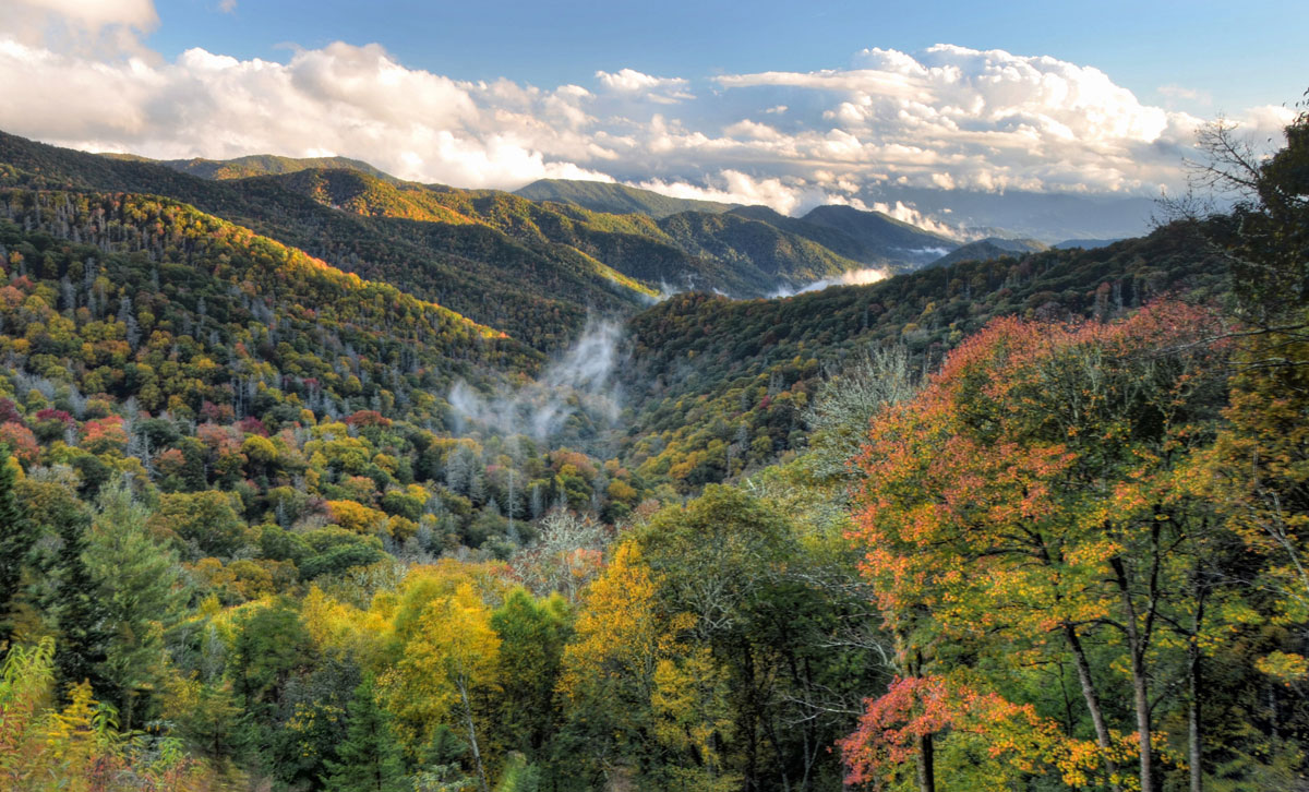
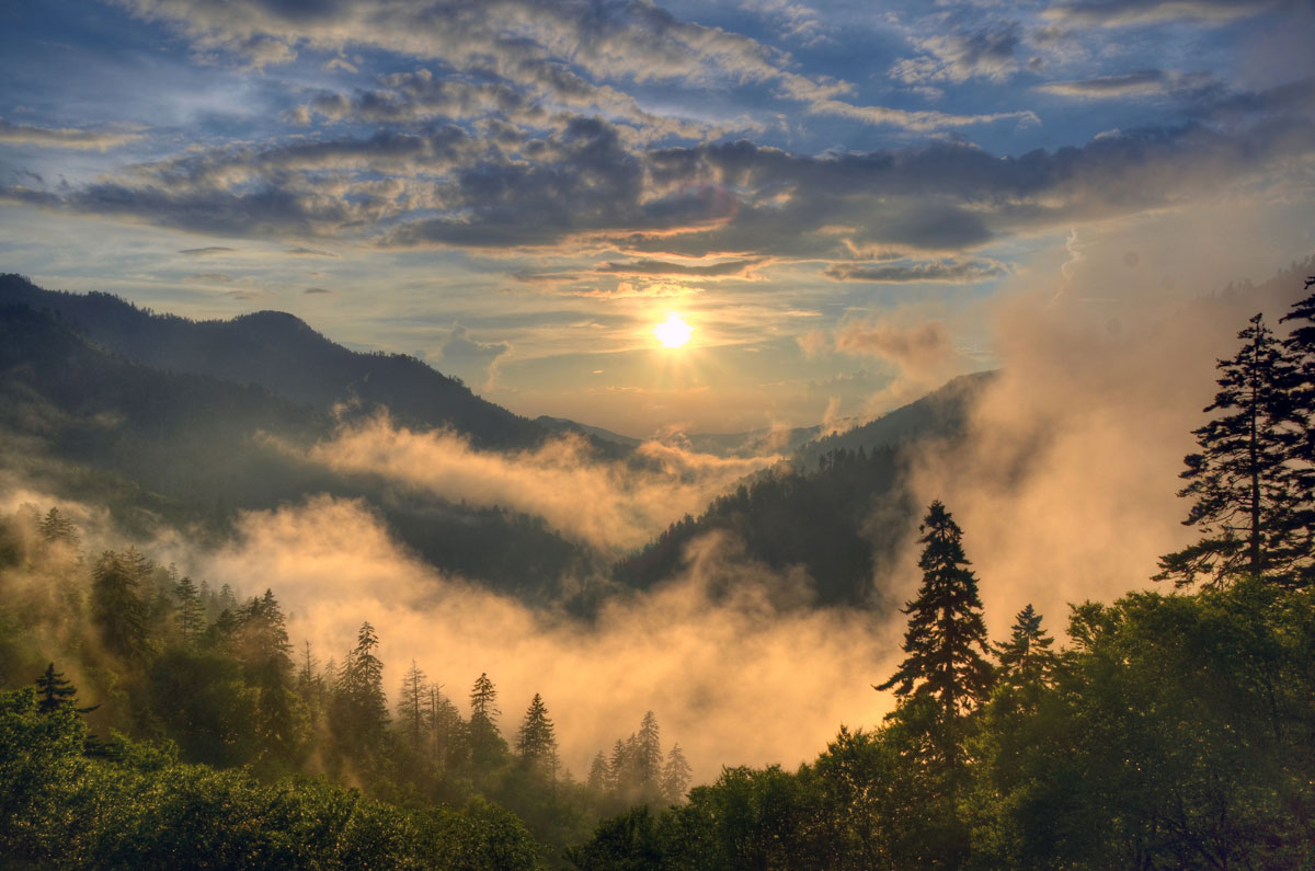
At 15.6 miles, you will arrive at the best spot for sunrise photos – Oconaluftee Valley Overlook. When you approach this overlook, the parking lot is on the left, however the view will be to your right. There is plenty of parking here, but photographers will arrive long before sunrise to get prime spots for sunrise photography.
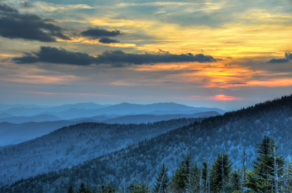
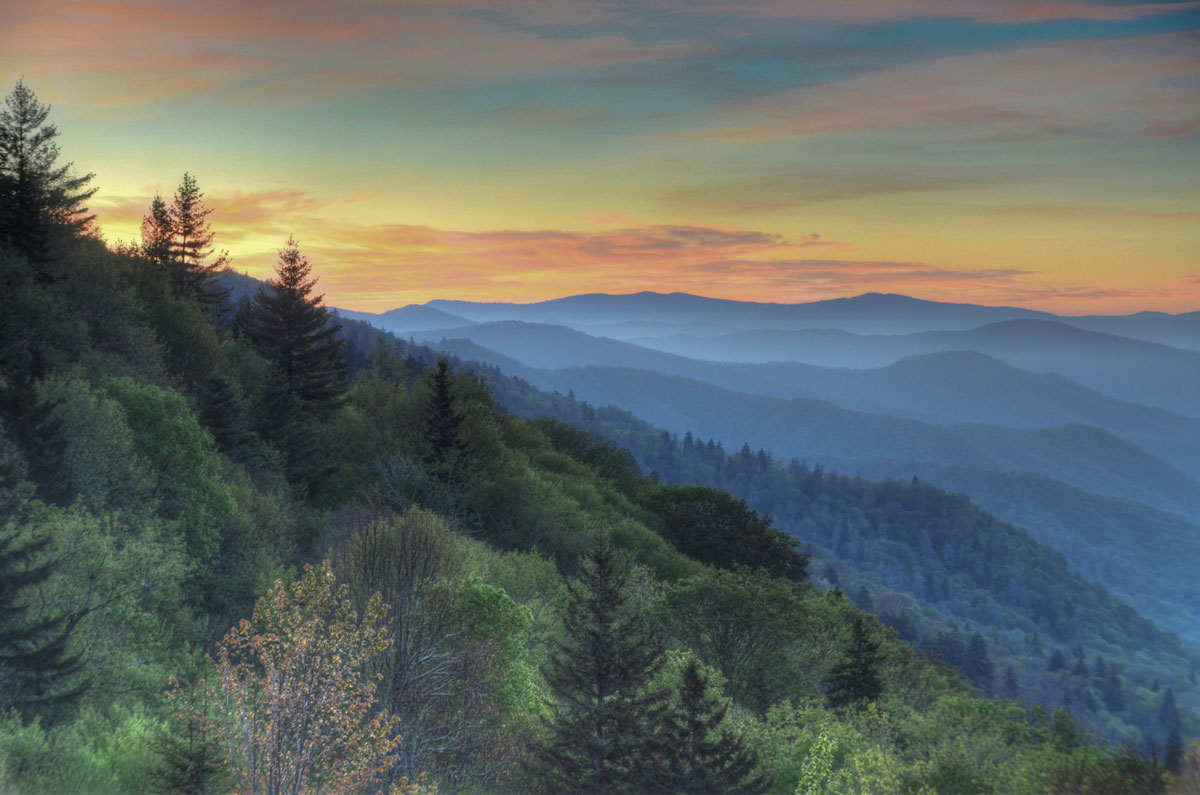
At 16.2 miles is the left turn onto Kuwohi Road. (formerly Clingmans Dome Road) .Follow the 7-mile-long road to the large parking area at the end. This is a great location for sunset photography, 2nd only to Morton Overlook (see below). You don’t have to climb to the observation tower to get your best sunset photo; you’ll capture fabulous photography from the parking lot. However the best vantage point will be at the farthest end of the parking lot. Some people like this area for sunrise photography, however we prefer the Oconaluftee Valley Overlook for this purpose
At 16.3 miles – assuming you didn’t make the left turn at Kuwohi Road, make the right turn into the Newfound Gap parking area. This is usually crowded, especially during peak tourist season. This is where the NC/TN state line is clearly marked, where the Appalachian Trail crosses, and is the site of the September 1940 formal dedication of the Park by President Franklin Roosevelt who spoke from the Rockefeller Memorial. There are also public restrooms here. Photo opportunities here are limited, however for long range views, step to the far right side of the parking lot, and you can view south along the ridges that define US 441, Newfound Gap Road.
At 17.1 miles Morton Overlook is the best place in the Park to view the sunset. At certain times of year, the sun will align itself between the peaks as it goes down, including the month of May. Plan to arrive here at least one hour ahead of time, especially on weekends or during the peak tourist seasons. Parking spots and prime viewing locations fill up quickly.
If you continue north on Newfound Gap Road (US 441), you’ll find the trailheads for Alum Cave and Chimney Tops, as well as other low elevation overlooks as you approach the Gatlinburg TN area. Turn left on Little River Road to reach the Elkmont, Tremont, and Cades Cove areas. Or turn right in Gatlinburg and look for the Roaring Fork Nature Trail (also part of the Park) for streams and historic structure photography.
Tips for capturing your best photography in the Great Smoky Mountains National Park:
- Be patient — Photographers often pack up and head home when the fog or rain clouds roll in. Stay behind to capture a break in the clouds that can reveal sun rays, fog in the valleys, and spectacular skies.
- Any lens you bring will capture beautiful views in the Smokies, but with various levels of ridge lines and peaks, we recommend that you bring your wide-angle lens along. Also bring a tripod because it can get quite windy.
- Weather is constantly changing in the Smokies. Bring a jacket, good hiking boots, and rain gear.
Lodging — In the Bryson City area you’ll find a wide variety of lodging, from familiar hotel chains to unique lodges and inns to mountain cabins and campgrounds. Our lodging directory is where you’ll find the perfect accommodations for your Smoky Mountains getaway.
Bryson City - Swain County
Chamber of Commerce
P.O. Box 509
Bryson City, NC 28713
Ricky Sanford
Administrative Coordinator
828-488-3681