
Nantahala River Gorge Activities
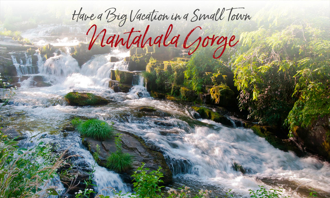
Over the course of centuries, the Nantahala River carved out an eight-mile gorge so deep that many parts of it see direct sunlight for only a short time each day. The Cherokee called the gorge ‘Nantahala’ which means “Land of the Noon-day Sun.”
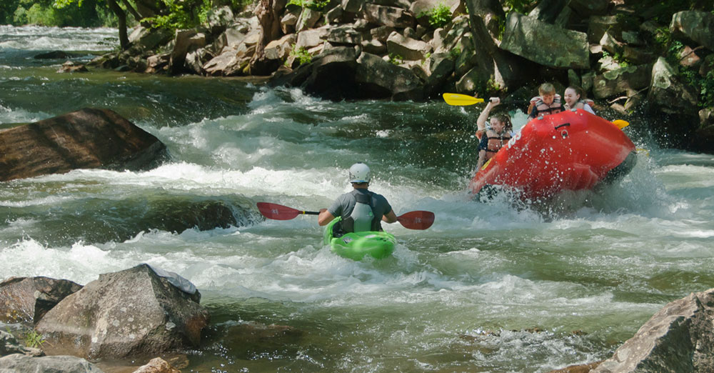
The Nantahala is the center of Bryson City’s most popular outdoor activities — whitewater rafting, kayaking, zip lining, fishing, jeep tours, horseback riding, hiking and gem mines. Rafting alone lures more than 200,000 paddlers every year making it one of the most popular whitewater rafting rivers in the Southeast. A number of rafting and kayaking outfitters offer guided and self-guided trips down the lower Nantahala’s eight-mile whitewater venue with one outfitter where you can raft with your dog (35+ lbs). . And two of those outfitters also operate zip lines and canopy tours, as well as rope courses, adventure net play for kids and kids zip lines.
A perfect combination of exciting whitewater and placid pools, the Nantahala is a great introduction to the sport of whitewater paddling. With Class II and III rapids, it’s considered a “family” river suitable for senior citizens and children — providing the kids are at least 7 years old or weigh at least 60 pounds.
But, don’t get the wrong idea. Just because the river is suitable for families doesn’t mean it’s not exciting; canoe and kayak Olympians often train on the Nantahala. In 2013, the Gorge was the site of the International Canoe Federation’s Freestyle World Championships. The “Championship Wave” the competitors used is open for public use.
NOTE: any private boating activity on the river requires a USFS Nantahala River Permit (available at Nantahala Outdoor Center and Endless River Adventures)
A Dam-controlled River
Nantahala Dam was completed in 1942 creating a reservoir that was critical to the success of defense projects for World War II. The dam allowed control of water not only for power usage, but also to provide recreational activities. Today it’s part of Duke Energy.
To serve both needs, the Nantahala River takes two separate paths below the dam. One is the continuation of the Upper Nantahala river along its centuries-old path down the mountainside. The other path is controlled by Duke Energy and scheduled to provide both power and a full flow for recreation.
Power generation is year-round. But from March thru October, Duke schedules its power generation operations to provide flow releases for the Lower Nantahala’s rafting and kayaking activities. When power-generation is ‘on’, water from the lake is released into a large pipe that carries it directly from Nantahala Lake to the Duke Energy hydroelectric plant at the bottom of the mountain. Below the power plant, both stream paths converge at the rafting put-in area.
Click or tap map to enlarge

Learn more in Lance Holland’s book, “The Nantahala River: A History and Guide”. Website
Bryson City Kayaker Paddles From Nantahala to Paris Olympics and Returns with a Bronze Medal
In Bryson City, Take “The Fugitive” Escape Day Trip
A “great escape” mountain road trip to Western North Carolina’s signature lakes, rivers and dams.
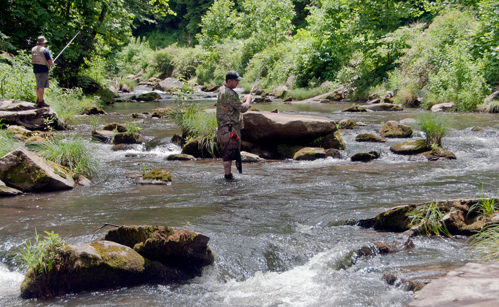
Lower Nantahala Fishing
The Nantahala has been named one of the top trout streams in the country, and rated as one of the Top 100 Trout Rivers in North America by Trout Unlimited. It’s well known for its population of large trout, primarily browns and rainbows.
The depth and flow of the Lower Nantahala is dependent on Duke Energy’s power generation schedule. When the river is turned “on” there’s a rapid rise of very swift water and anglers must share the river with kayakers and rafters. While the schedule varies from month to month, the river is generally “turned on” mid-morning and “turned off” late afternoon. The fish are accustomed to the recreational activity, however, so the fishing is not compromised.
The lower Nantahala is classified as Hatchery-Supported Trout Waters with no size limit or bait restriction and a creel limit of seven trout per day. But because this is where most of the rafting and kayaking activity occurs, the Lower Nantahala is the only stream in the state where night fishing is allowed.
Upper Nantahala
When you venture up the mountain above the Nantahala Gorge, there’s an entirely different Nantahala — a scenic mountain river with world-class trout fishing. The Upper Nantahala’s flow is completely separate and is unaffected by Duke Energy’s releases.
The section of Upper Nantahala that follows Wayah Road above the Duke Energy Power Plant is classified as Delayed Harvest Trout Waters. It may be fished only with artificial lures with one single hook (no natural bait). And there are strict seasonal restrictions between October and June.
There are five fish/canoe/kayak access points along Wayah Road. And a handicapped accessible fishing pier on Wayah Road about a quarter-mile above the power plant.
Recreational Releases — Several times each summer, American Whitewater and Duke Energy open the tainter gates on Nantahala dam and transform the Upper Nantahala into a world class whitewater river with Class III+, IV and V rapids. Recreational release schedule.
The Cascades
In addition to world class fishing, the Upper Nantahala is also one of the most scenic mountain drives in the Southern Appalachians. Wayah road hugs the river almost all the way to the mountaintop, with pull-offs along the way. And near the top, there’s an observation deck overlooking the spectacular Nantahala Cascades.
Lake
At 3000 feet elevation, Nantahala Lake is the second highest lake in the eastern US — a crystal clear lake with boating, fishing and natural beauty. Fish in the lake include walleye, crappie, sunfish, trout, and bass. And it’s the only lake in the South with a population of freshwater kokanee salmon.
Wayah Bald
Above Nantalaha Lake, Wayah Bald offers spectacular panoramic views of the Great Smoky Mountains to the north and the Georgia mountains to the south. A stone fire tower, built in 1937, is at 5342 feet elevation, the highest point. Both the Appalachian and the Bartram trails cross Wayah Bald. From Wayah Road, take Forest Service Road 69 4.3 miles to the parking lot. This road is closed January thru March.
Bike-Hike-Ride
Two nationally-known trails pass through the Nantahala area. A section of the Bartram Trail stretches 21 miles (a two-night hike) from the Duke Energy Power Plant on Wayah Road to Wayah Bald. See map. And the Appalachian Trail can be accessed from Wayah Road southeast of Nantahala Lake and at the Nantahala Outdoor Center. Above the Nantahala Outdoor Center, the Flint Ridge Trail is open for public use.
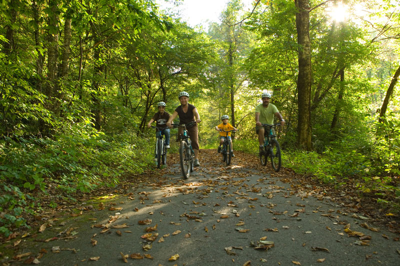
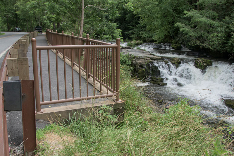
For the less-adventurous, guided horseback riding is available at Nantahala Village Riding Stables on Hwy 19. And near the rafting put-in parking lot on Wayah Road, a foot bridge bridge leads to the Nantahala River Bike Trail, a wide, paved bikeway that follows the river. The 2-mile pet-friendly trail (out and back) is perfect for walkers, bikers and strollers.
Bryson City - Swain County
Chamber of Commerce
P.O. Box 509
1191 Main Street
Bryson City, NC 28713
Hours 10am – 2pm
Mon, Tues, Thurs, Fri
Ricky Sanford
Administrative Coordinator
828-488-3681

Order a free Visitor Guide featuring Bryson City and the North Carolina Smokies
*