
Spend any time in the Smokies and you’re bound to encounter a lot of names unique to the area. Many were derived from the Cherokees who have called this place home for thousands of years. Other names were coined by the Europeans that settled in Western North Carolina in the 1700s.
Allen R. Coggins, in his book ‘Place Names of the Smokies’, wrote “Place names are more than mere words used to label points on a map. They are narratives that collectively chronicle the history of an area – be it a nation, county, or a small hollow in the Southern Appalachian Mountains.”
Here are a few of our favorite backstories for locations surrounding Bryson City, beginning with the most familiar name of all: “Smoky Mountains“ which was originally named by the ancient Cherokees. They referred to the area as “Shaconage” (sha-KON-o-Hey), which means “land of the blue smoke.”
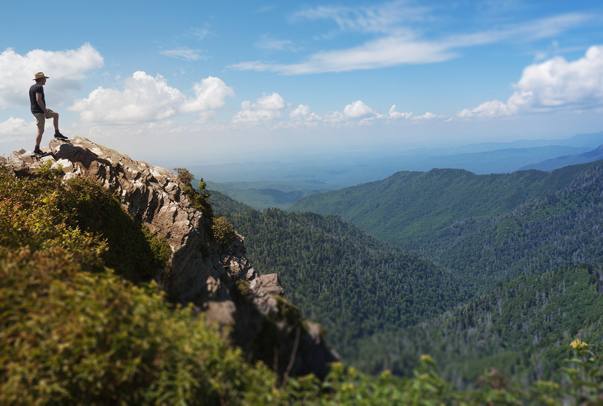
Charlies Bunion (above)
It is rugged and ragged — a sort of obstructive bump along the Appalachian Trail just four miles north of Newfound Gap. In 1929, surveyor and local writer Horace Kephart named the spot after fellow surveyor Charlie Connor. During a survey of the area, Connor’s foot began to ail him. Kephart jokingly said a rocky formation they encountered looked like “Charlie’s Bunion.”

Kituwah (gid-OO-wa)
With more than 2000 years of continuous human habitation, Kituwah is known as the mother town of the Cherokee. Located on the Tuckasegee River, just north of Bryson City, the Cherokees built ceremonial earthen ‘platform’ mounds at this location. Today, the mound is five feet tall, although archeologists know that it was once taller. This sacred site is located on US 19 between Bryson City and Cherokee, and it is a beautiful spot for an easy walk or run beside the Tuckasegee River.
Clingmans Dome
At 6625 feet elevation, Clingmans Dome is the highest point on the entire Appalachian Trail. In 1859 it was named for Thomas Lanier Clingman, a Confederate General and NC Senator. Efforts by The Tribal Council of the Eastern Band of Cherokee Indian are currently underway to get the name changed to Kuwa’hi or Mulberry Place (“Ku wa” means mulberry and “hi” means place).
Shuckstack
This mountain peak on the Appalachian Trail earned its name for its resemblance to corn stalks during fall harvest. The Shuckstack Tower is a popular yet strenuous 3.5 mile hike (each way) above Fontana Dam.
Road to Nowhere
The local name given to the unfinished Lakeview Drive in the National Park just north of Bryson City. The road had been promised to Swain County after a different road – Highway 288 – was flooded to create Fontana Lake. Read the full story.
Advalorem Branch
A curious name meaning ‘tax value of property’ is a bit of a mystery. While it’s one of Allen Coggins’ favorites, he wrote, “There’s no reason a place would be called Advalorem in the middle of the Great Smoky Mountains.” But when you consider that in the 1930s, after much of Swain County’s private, taxable property had just been purchased by the Federal Government, there was probably an element of sarcasm in the name.

Newfound Gap
Named after a new passage discovered in the late 1850s, Newfound Gap offered settlers a shorter route through the main range of the Smoky Mountains. A stop on the Newfound Gap Road (US 441) in the GSMNP provides beautiful mountain views and a fun photo-op at the sign dividing North Carolina and Tennessee.

Tuckasagee River
‘Tsiksitsi’ is the Cherokee name of what early English settlers called the Tuckasegee River. Tsiksitsi is said to mean ‘crawling terrapin’ as a nod to its unhurried pace. Variant spellings include Tuckaseegee and Tuckaseigee, but most locals just call it ‘The Tuck’. Beginning in the mountains of Northeast Georgia, the river flows in a northwesterly direction for approximately 60 miles before flowing past Kituwah, the mother town of the Cherokee Indians and entering Fontana Lake just west of Bryson City.
Oconaluftee River
From headwaters near Newfound Gap, elevation 5,048 ft., the Oconaluftee is considered sacred waters by the Cherokee. The name is derived from ‘Egwanulti’, a Cherokee word meaning ‘by the river’. The ‘Lufty’ flows rapidly, dropping elevation quickly and picking up numerous tributaries along the way to merge with the Tuckasegee River just west of Cherokee, near the Kituwah Mound.
In the Cherokee language, Nun’daye’li are the words for ‘middle’ and ‘sun’. This has been interpreted to mean “Land of the Noonday Sun” because the river runs through a narrow and steep 8-mile gorge where in some areas the sun reaches the found only when it is directly overhead during the middle of the day.